Another dangerous line of severe storms is expected to move through the region tonight, bringing the threat of tornadoes — including strong, long-track tornadoes — along with damaging winds and large hail, according to the National Weather Service. The forecast also calls for another 4-8 inches of rain through Saturday, which could result in dangerous flooding.
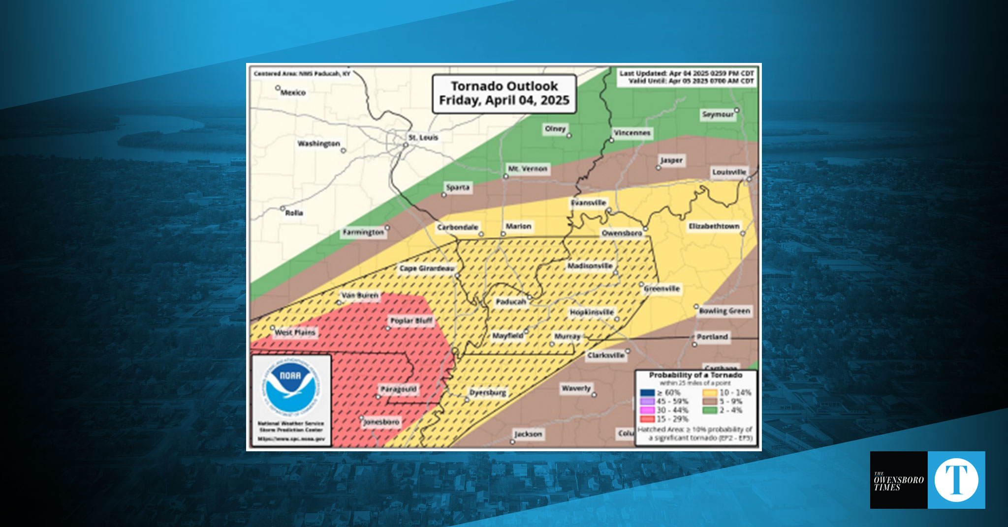
NWS has placed Daviess and surrounding counties under an Enhanced Risk (Level 3 of 5) for severe weather through early Saturday morning. Tornadoes are possible during both isolated storms this evening and a more organized line of storms expected to move through the area in the overnight hours through 4 a.m., according to the forecast.
Meanwhile, heavy rainfall over the past several days has already led to flash flooding in parts of western Kentucky, and the risk is expected to worsen. The NWS forecasts an additional 4-8 inches of rain through Saturday night.
The flooding could be widespread and life-threatening and impact areas that don’t typically flood, the weather service said. A Flood Watch remains in effect through Saturday night, with river flooding expected to persist well into next week.
Another round of severe storms is possible Saturday afternoon into Saturday night. All severe weather threats remain possible throughout the weekend.
Officials urge residents to prepare now, stay weather aware, and be ready to take shelter or move to higher ground at a moment’s notice.


